
Carrigroe Hill [Cnoc na Carraige Rua]
Good walks are even better shared.
Overview
Carrigroe Hill [Cnoc na Carraige Rua]
Overview
Carrigroe Hill, standing at a modest 405 meters, may not be the highest peak in Ireland, but it holds its own charm and beauty. Nestled in the Slieve Felim mountains, it boasts panoramic views that make the climb worthwhile.
Routes
The most popular route to the summit begins at the west side, taking about 2.5 hours to complete. Hikers will appreciate the gradual rise, which allows for the enjoyment of the surrounding nature, including some very friendly sheep who are keen to offer their opinions along the way!
Summit Features
When you reach the top, you’ll be greeted by a rocky outcrop topped with a small cairn. It’s the perfect place to pause for thought or to take that much-anticipated summit selfie. After all, what’s a hill climb without a bit of social media bragging?
Terrain Type
Expect a mix of grassy patches and rocky terrain, making for a varied hiking experience. A bit of heather adds a splash of colour — perfect for those Instagram shots!
Views
Highlights
On a clear day, the views extend far and wide. You can gaze upon the majestic Silvermines Mountains and the lush rolling valleys that surround them. Don’t forget your binoculars; those faraway peaks look even more impressive with a bit of zoom!
Best Seasons
Spring and autumn are ideal for this hike. Spring brings flowers galore, while autumn showcases a riot of colours. In other words, it’s a feast for the eyes, so don’t forget to pack your camera!
Hazards
Be mindful that the weather can change in the blink of an eye here. Rain can make paths slippery, so sturdy footwear is recommended. Always check the weather forecast before you head out.
Nearby Summits
For the dedicated bagger, consider extending your hike to nearby Slieve Felim and Keeper Hill. Both offer exciting challenges and the promise of more stunning views!
Access
Nearest Parking
You can park nearby at T087490, though space is limited. On weekends, it’s best to arrive early to secure a spot — nothing worse than circling like a seagull at a picnic!
Public Transport
Buses run to Puckane, a short taxi ride from the hill’s trailhead. It might take a bit of planning, but it’s a viable option if you're looking to conserve your fuel.
Nearest Town
Kilcommon is the closest town, offering amenities, cafes, and friendly locals ready to share the best walking routes.
Facilities
While there are no facilities on the hill itself, Kilcommon has everything you need to refuel after your descent. Grab a cup of tea or a hearty meal — you’ve earned it!
History
Name Meaning
Cnoc na Carraige Rua quite literally means ‘Hill of the Red Rock’, a nod to the charming geology of the area.
Significance
Rich in local folklore, Carrigroe Hill has stories of history and myth woven into its very fabric. It’s not just a hike; it’s a passage through time!
In conclusion, whether you're out for a casual stroll or looking to tick off another peak on your list, Carrigroe Hill offers a delightful outdoor experience. Happy hiking!
Explore routes near Carrigroe Hill [Cnoc na Carraige Rua]
Public walks starting within 80 km of this hill. Nearby does not mean a route reaches the summit; check its map and access before setting out.
No public routes are currently listed within 80 km of Carrigroe Hill [Cnoc na Carraige Rua] on Walkmates. This does not mean there are no paths here. Explore the map and check local access information before planning a walk.
Route planning notes
These notes describe possible approaches, not verified navigable routes or permission to cross land. Check current paths, local access rules and conditions before setting out.
Main Trail from the West
A well-trodden path from the west side of the hill offering gradual ascents and scenic views.
Make a day of it, together
Find someone to share the walk with, or organise a day out along a route you like.
Hill facts and local notes
Classifications
Elevation
232m
761 ft
Prominence
193m
Coordinates
52.5886, -6.3881
T092497
OS Map
69
At the Summit
The summit features a distinct rocky outcrop with a small cairn. It's a great spot for a selfie or for contemplating your life's choices.
Terrain & Geology
Carrigroe Hill is primarily composed of sandstone and shale, characteristic of the surrounding area, giving it a rugged yet inviting appearance. The geology dates back to the Carboniferous period, providing insights into the earth's history.
Views & Scenery
Magnificent views of the nearby Silvermines Mountains and the lush valleys below, with a clear day revealing stretches as far as the Galtees.
History & Heritage
Name Origin
Cnoc na Carraige Rua translates to 'Hill of the Red Rock', reflective of the reddish hue of the local stone.
Historical Significance
The area is steeped in local folklore, with stories of ancient peoples and mythical creatures said to inhabit the hills.
Getting There & Facilities
Check current local access restrictions, parking rules and transport timetables before travelling. These notes do not confirm public access to the summit.
Parking
There is a small parking area at T087490, suitable for a few cars. It's advisable to arrive early on weekends to nab a spot.
Public Transport
Bus services run to the nearby village of Puckane, from where a taxi service can be arranged to the trailhead.
Nearby Facilities
Facilities are limited on the hill itself, but Kilcommon offers cafes, pubs, and restrooms for visitors.
Safety Information
Known Hazards
- Rapid weather changes can occur; ensure to check forecasts before setting out. Some sections may be slippery after rain.
General Safety Tips
- Check weather conditions before setting out
- Carry appropriate clothing and equipment
- Let someone know your planned route
- Take a map, compass, and GPS device
- Carry emergency supplies: food, water, first aid kit, torch
Hills
Some common questions about the hills answered
Are there group walks up Carrigroe Hill [Cnoc na Carraige Rua]?
Many walkers use Walkmates to join or organise walks with others. You can check for group walks around Carrigroe Hill [Cnoc na Carraige Rua] through the maps
Are there other walkers around Carrigroe Hill [Cnoc na Carraige Rua]?
Activity varies by location and time, but Walkmates lets you see whether others have shared walks or shown interest in this area. Find other people through the walking friends search walking friends for Carrigroe Hill [Cnoc na Carraige Rua] search or of course create your own walk for Carrigroe Hill [Cnoc na Carraige Rua]
Can I organise a walk to Carrigroe Hill [Cnoc na Carraige Rua]?
Yes. If there aren’t any walks listed already, you can create a walk and make it available for others to join.
If you're signed up to Walkmates, you can create a walk to Carrigroe Hill [Cnoc na Carraige Rua].
How do I find a walk up this hill?
There are often multiple ways to walk this hill, depending on experience and route preference. Walkmates helps you explore walks and routes that others have shared.
Can I suggest a new route up Carrigroe Hill [Cnoc na Carraige Rua]?
Yes. You can suggest or create routes to share with others. Walkmates focuses on the social side of walking, so routes are used to help people organise walks and explore areas together, rather than as detailed navigation tools or route libraries.
Other uses really appreciate knowledgeable walkers sharing their routes. Share your favourite route to Carrigroe Hill [Cnoc na Carraige Rua] here
The is an error or something incorrect about this hill. How do I let you know?
We always strive to keep the information on Walkmates as accurate as possible. If you find an error, please let us know through the contact form and we'll aim to correct it as quickly as possible
Community Discussion
Comments
Location
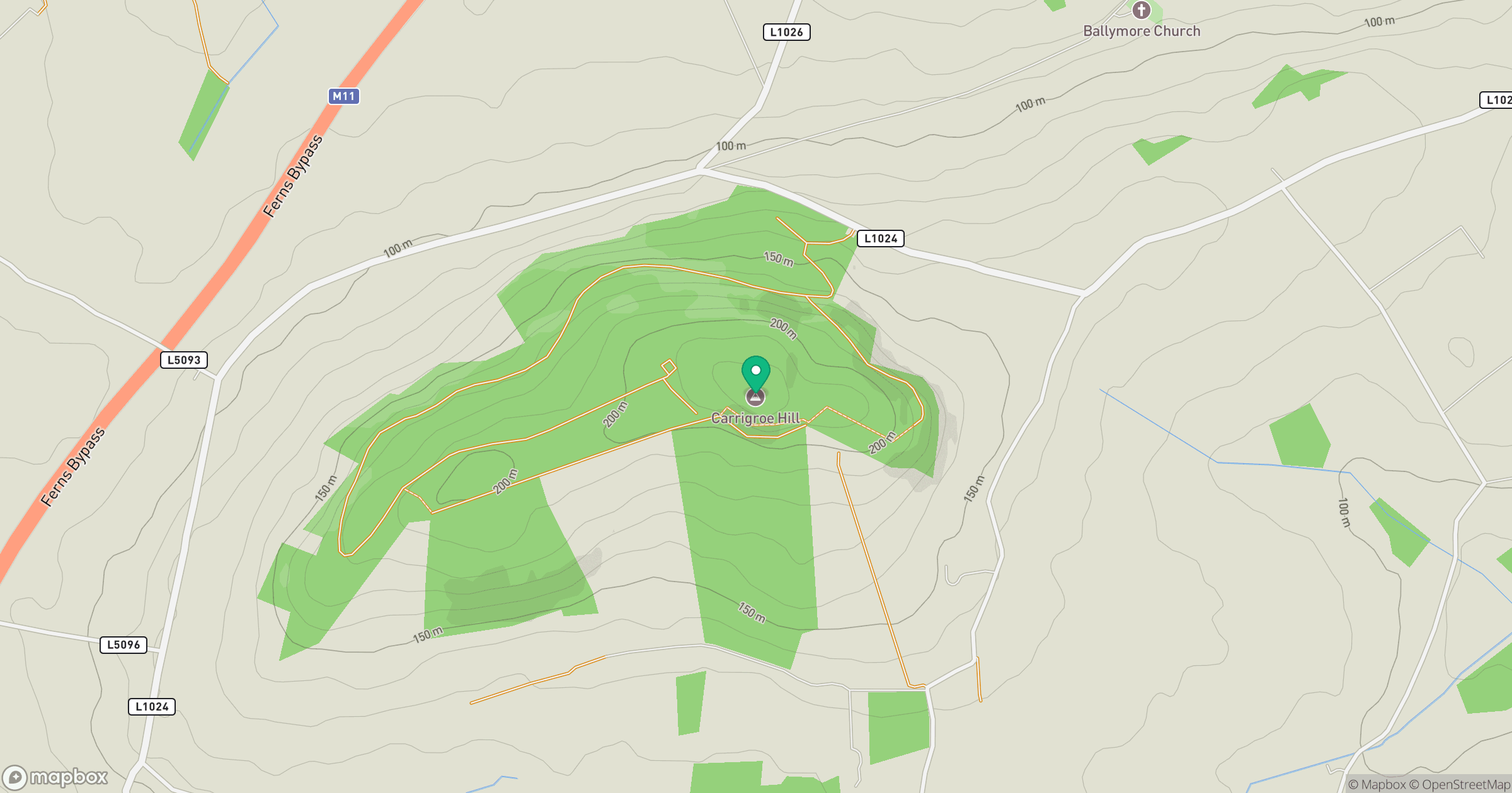
Grid reference: T092497
View on OpenStreetMapOpens a map in a new tab, centred on the hill.
Hills within 30 km
Straight-line distance, not a walking route or confirmation of access.
No comments yet. Be the first.